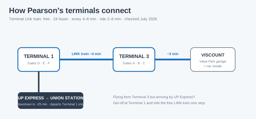
Toronto Pearson (YYZ) has two passenger terminals: Terminal 1 with gates D, E and F, and Terminal 3 with gates A, B and C. There is no Terminal 2, so the first thing to read off any Pearson map is the gate letter on your boarding pass, because it tells you the terminal. The free LINK train connects the two buildings in about 4 minutes, 24 hours a day. Below are simplified schematic maps of both terminals, the walking times from security to the farthest gates, and where the UP Express to downtown departs. Gate ranges checked July 2026.
How is Toronto Pearson laid out?
Picture Pearson as two separate buildings joined by one short train line. Terminal 1, the larger and newer building, sits closest to the UP Express station. Terminal 3 sits one LINK stop away, with the Viscount Value Park garage and the car rental centre one further stop down the same line. Airlines never share a flight between the buildings: a departure lives entirely in T1 or entirely in T3. So the practical rule is simple: confirm your terminal before choosing a parking garage, hotel or drop-off door, because correcting the mistake costs a train ride with luggage. If you only remember one thing from this page, make it the gate-letter rule: A, B, C mean Terminal 3, while D, E, F mean Terminal 1.
What does the Terminal 1 map look like?
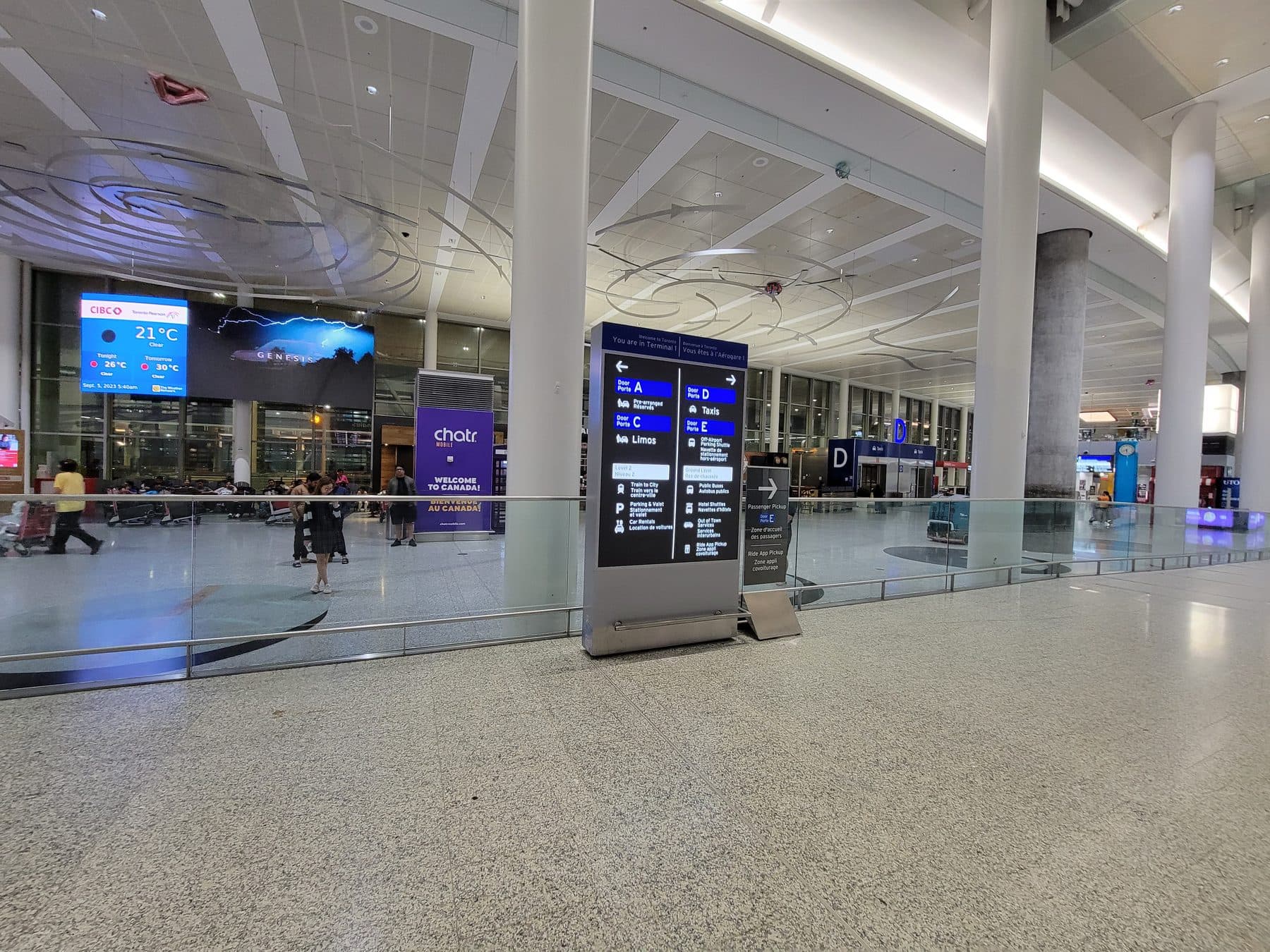
Terminal 1 is one curved building with three gate piers. Pier D (gates D1 to D57) handles mostly domestic flights, pier E (gates E68 to E81) serves international departures, and pier F (gates F60 to F99) is the US preclearance zone, where you pass American customs before boarding. Check-in and departures sit on Level 3, domestic arrivals on Level 2, and ground transport on Level 1. Walking from the central security checkpoint takes 2 to 15 minutes to D gates and 2 to 11 minutes to E and F gates, so a far gate is a real walk: leave the shops with 20 minutes in hand. The downtown train platform and the LINK station both sit beside this building, marked on the diagram below.

What does the Terminal 3 map look like?
By contrast, Terminal 3 is a straight building with three piers behind a single security checkpoint on Level 2. The A gates (A1 to A6) sit closest to security, about a 2 to 3 minute walk. The long B pier (gates B1 to B41) takes 8 to 10 minutes to its far end, and gates C30 to C41 are the farthest at 10 to 12 minutes. Arrivals, baggage claim and customs are on Level 1; check-in and all departures are on Level 2. Level 3 holds two things worth knowing: the walkway to the Sheraton Gateway, the only hotel inside the airport, and the LINK train platform to Terminal 1. WestJet, Delta, American, British Airways, Flair and Porter all operate from this building, as our airline terminal guide breaks down carrier by carrier.

How do you get from Terminal 1 to Terminal 3?
Take the LINK train: it is free, runs 24 hours a day, departs every 4 minutes at peak times (every 8 minutes off-peak), and the ride takes about 4 minutes between the terminals. The stations sit landside, before security, so if you have already cleared security you will need to re-clear it at the other building; budget 30 to 40 minutes for the whole move at busy hours. No marked pedestrian route exists between the buildings, so the train is the way. One trap worth naming: the UP Express from downtown stops only at Terminal 1. Flying WestJet, Delta or another Terminal 3 carrier? Get off at Terminal 1 and ride the LINK one stop; details of both trains are in our Terminal Link and transport hub.
Which gates are in which terminal?
The gate letter on your boarding pass is the fastest map you have. This table is the whole system:
| Gate letter | Terminal | Typical flights | Walk from security |
|---|---|---|---|
| A1-A6 | Terminal 3 | domestic and international | 2-3 min |
| B1-B41 | Terminal 3 | international and US | 8-10 min |
| C30-C41 | Terminal 3 | international | 10-12 min |
| D1-D57 | Terminal 1 | mostly domestic | 2-15 min |
| E68-E81 | Terminal 1 | international | 2-11 min |
| F60-F99 | Terminal 1 | US preclearance | 2-11 min |
Gate assignments can shift on the day, so treat the boarding pass and the departure boards as the final word; ranges above checked July 2026 against the official Toronto Pearson maps. A full walkthrough of each building, including food and services, lives on our terminals guide.
What is changing during the LIFT construction?
Pearson began a multi-billion-dollar modernization program called LIFT (Long-term Investment in Facilities and Terminals) in 2026, and the work will run for about a decade. For travellers the practical effects appear gradually: temporary hoarding inside piers, shifted walking routes, and occasional changes to curb access and parking, rather than terminal closures. Gate letters and the two-terminal layout stay as shown on the maps above. Our rule for construction season: add 10 spare minutes to any connection that involves changing terminals, and glance at the airport's what's-happening notices on the day you fly. This page is updated as LIFT milestones change the maps, so the schematics you see here match the current layout, checked July 2026.